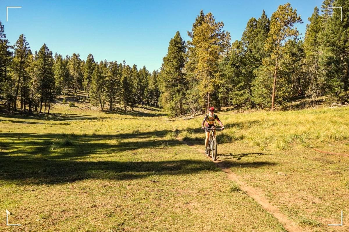
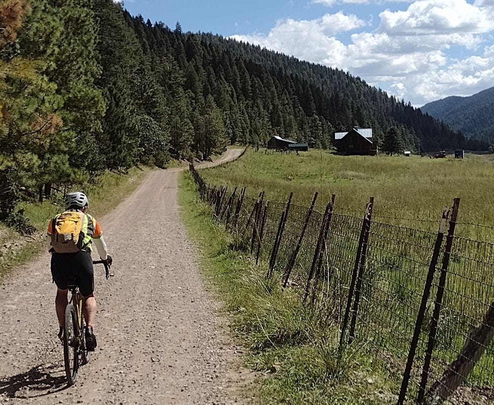
Cloudcroft presents a diverse range of mountain biking trails, each distinct in features and challenges. The Alamogordo-Cloudcroft Rail Trail, a 20-mile loop, combines history and nature with a blend of smooth and rocky terrain. Elevations range from 7,680 to 8,650 feet, featuring historical sites and spectacular views. The trail includes various spurs and is rated intermediate, with a particularly steep section on the Switchback Trail.
The High Altitude Racing Loop challenges seasoned riders with grueling ascents, technical singletracks, and thrilling downhills over a 10-mile loop.
Cloudcroft also hosts over 63 mountain bike trails and 45 e-bike trails, suitable for hiking and running. The area is known for the High Altitude Classic event. Trails like Salado Canyon and Grand View offer varied experiences for different skill levels.
Several specific trails include the Mexican Canyon Trestle Trail, known for its historical plaques and views, and the Sacramento RD, offering diverse recreational activities. The A Trail (T119), Alamo Canyon Trail (T104), Alamo Peak Trail (T109), Apple Tree Canyon Trail (T5601), Atkinson Field Trail (T111), and Benson Canyon Spur Trail (T5005A) range from 0.8 to 7.3 miles, catering to varying levels of difficulty and experience.
Other trails in the area, such as Salado Canyon Trail, Grand View Trail, Cloud-Climbing Trestle Trail, and various trails in La Luz, NM, like the High Altitude Big Eight, High Altitude Race Loop, and the NMES Sacramento Rim Roller, offer a range of experiences from moderate to difficult, accommodating different biking preferences and skill sets.
Alamogordo-Cloudcroft Rail Trail:
Description: This trail is a 20-mile loop that was once part of the Alamogordo and Sacramento Mountain Railroad. It features a blend of history, nature, and cycling challenges.
Elevation: Ranges from 7,680 to 8,650 feet with a 1,000-foot vertical change, demanding a good level of fitness.
Scenery: The trail showcases historical remnants like the ruins of the Trestle, spectacular views of the White Sands National Monument, the Tularosa Basin, and the San Andres Mountains, along with dense old-growth forests.
Options: Includes multiple spur options like the Village Spur Trail, Old Road, and Switchback Trail.
Difficulty: Intermediate level, with trail sections varying from smooth earth to rocky patches. The Switchback Trail features a steep section with a 35% grade.
Facilities: Trestle Recreation Area offers restrooms, picnic tables, and interpretive signs.
Tips: Layered clothing is recommended during cooler months, and alternate parking options may be advisable due to overgrown brush and large rocks near the Trestle Recreation Area.
Location: Starts at the Trestle Recreation Area in Cloudcroft, just off Highway 82.
High Altitude Racing Loop:
Difficulty: Difficult level, best suited for seasoned riders.
Features: A mix of grueling ascents, technical singletracks, and exhilarating downhills.
Distance: Approximately 10 miles.
Trail Type: Loop.
General Trail Information:
Variety: Cloudcroft offers over 63 mountain bike trails, 45 e-bike trails, and trails suitable for hiking and trail running.
Event: It is home to the High Altitude Classic, a notable event in the area.
Accessibility: Trails like the Salado Canyon Trail and Grand View Trail are among the popular choices, with more than 4 trails covering 6 miles available for varying skill levels.
Specific Trails:
Mexican Canyon Trestle Trail: A mile-long trail notable for its historical plaques and views of the White Sands. It is part of a network of trails in the Trestle Recreation Area, allowing for hikes of varying lengths.
Surrounding Trails: Other trails easily accessible near Cloudcroft include the Switchback trail, Old Cloudcroft Highway, and the Osha trail.
Sacramento RD: This trail offers many different recreation opportunities for all seasons. It has trails ranging in use from hiking, pack/saddle, mountain biking, motorcycle riding, and ATV riding1.
A Trail (T119): This trail is 5.0 miles long and connects Alamogordo to the Sacramento Mountains. It starts from the West Side Road and ends at a junction between T1129 and T557423.
Alamo Canyon Trail (T104): This trail is 7.3 miles long. It begins at the upper end of the path, which overlies a narrow utility road that passes through a large meadow. The trail descends into Pinyon-Juniper Woodland and other vegetation, along an intermittent stream45.
Alamo Peak Trail (T109): This trail is 3.0 miles long. It begins at Forest Road 64D and ends at West Side Road FR90. The top section is steep with loose switchbacks, then opens up to a fast section67.
Apple Tree Canyon Trail (T5601): This trail is 5.1 miles long. It begins at County Road C2 (Sacramento River Road) and ends at Forest Road 460C89.
Atkinson Field Trail (T111): This trail is 1.6 miles long. It begins at the Rim trail (T105) and ends at the Alamo Peak trail (T109)1011.
Benson Canyon Spur Trail (T5005A): This is a short 0.8 miles loop trail amongst the Benson Canyon area trails. It connects the two main trails in the area (T5005 and T5006) and can make for a lovely loop1012.
Salado Canyon Trail: Difficulty information is not specified, but it is listed among the best trails around Cloudcroft for walking or biking.
Grand View Trail: Suitable for hiking or mountain biking. The difficulty level is not explicitly stated, but it is mentioned alongside other popular trails in Cloudcroft.
Cloud-Climbing Trestle Trail: This trail is known for its historic plaques and scenic views. It includes a one-mile trail with a short descent and ascent, indicating a moderate difficulty level.
High Altitude Big Eight (La Luz, NM): Classified as Intermediate/Difficult. It covers a distance of 13.6 miles with significant elevation changes, indicating a challenging ride.
High Altitude Race Loop (La Luz, NM): Also rated as Intermediate/Difficult. This 8.2-mile trail features a mix of ascents and descents, suggesting a moderately challenging experience.
Rim Trail Ride from Slide Campground (La Luz, NM): This trail is also categorized as Intermediate/Difficult, spanning 20.3 miles with substantial elevation changes, making it suitable for experienced riders.
NMES Sacramento Rim Roller (La Luz, NM): Rated as Difficult. It's a lengthy 41.6-mile trail with considerable elevation gain and loss, designed for advanced riders.
Bailey Canyon (La Luz, NM): Classified as Intermediate. This 1.8-mile trail is more accessible but still offers a moderate challenge.
T5004 (La Luz, NM): Also an Intermediate trail, spanning 3.1 miles. It's likely to be moderately challenging.
T5002 (La Luz, NM): This 2.8-mile trail is rated Intermediate, indicating a moderate level of difficulty suitable for riders with some experience.
Singletracks Mountain Bike News
Directions, Maps, Photos, and ReviewsJohn Watson


